

Data Presentation by GPR
Ground Penetrating Radar (GPR) is a non-intrusive and near surface equipment which is used to get images of concrete subsurface and other objects at a much higher resolution. In GPR surveys, data can be displayed or analyzed in different ways. In order to get a high quality of data presentation, the results of GPR investigation are further processed and displayed in a 3-dimentional color report. Developments regarding acquisition methodology, post-processing software and using high frequency antennas have helped much in producing high resolution 3-dimensional images of the internal environment of concrete structures.
GPR interprets the collected data and displays it in the form of visualizations which can be easily interpreted by the analysts. In fact, displaying of data is an integral part of interpretation which is done accurately by radar in the form of 3-dimensional and 2-dimensional images.GPR can provide good data of buried objects in concrete as well as of voids and imperfections in the ground more accurately as compared to other equipments due to its high resolution images. 3D imaging can visualize deterioration in the lower and upper parts of concrete structures and corrosion of reinforced steel.
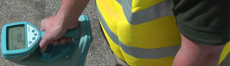
Radar is comprised of two antennas i.e. transmitting and receiving antennas. Transmitting antenna delivers sound waves into the concrete structure or any other material to be tested. These sound waves reach the internal or hidden objects and are thus reflected back to the surface. The reflected signal is collected by the receiving antenna and then the variation in the reflected signal is evaluated to produce images. Generally antennas are dragged on concrete surface in transects within a grid. The reflections are recorded per second and by plotting them in a vertical profile, a 2-dimensional vertical slice of reflections can be produced. By collecting many transects in a grid, a 3D database is acquired.
Radar can generate easy-to-interpret images from continuous profiles and 3D images can assist in knowing additional information which is difficult to collect on a single GPR record. 3D images can be generated by GPR in several different ways. GSSI's 16-bit 3D imaging program was not feasible due to its time consuming factor. This 3D imaging program consumed much time in getting field data and producing 3D images by first preparing 2D data. Moreover, its images were not meaningful enough. Sometimes the analysts were left confused regarding the exact location of underground utilities and voids when they used this software program. By using another software program named contour package, 3D imaging can be conducted without any consumption of time. This software has a special auto-pick program.
The images produced by full-resolution Ground Penetrating Radar are superior as compared to traditional 3D radar. The images generated by high resolution GPR are much easier to interpret than 3-dimensional images generated by traditional 3D radars. With the help of full-resolution images, the internal properties of concrete or other materials can be determined more accurately and precisely. Full- resolution data collection is beneficial in monitoring and evaluating concrete and other materials.